None of this is needed, but if anyone wants to immerse themselves…
My pacing plan
Where I plan to be and when, and how fast (and slow) I plan to do each section…
Note that while I’ve attempted to be scientific and rational, to give myself a plan to work to, this is subject to significant and growing error as the day progresses. If it were a level or mildly undulating route on roads, I would have a good stab at predicting it to within seconds or at least a few minutes. On this hugely varying terrain with enormous elevation gain (and at altitude), I just don’t know how it will go later on as the valley route turns after 26km into a mountain ascent, with the last sections on rocky hiking trails.
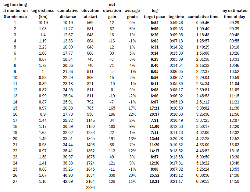
Note: the “time of day” assumes a prompt 0830 (Swiss time, 0730 UK time) start – it may take me a few minutes to get across the start line.
I need to be at Wengen railway station (30.7km) by 4h25 from the start (in practice 1300 Swiss time) and at Wixi (38.5km) by 5h50 from the start (in practice 1425 Swiss time). I’ve allowed some margin in advance of those – but if it’s going badly, one of those locations could be the end of the road. Equally, my planned paces uphill are deliberately conservative, so if it’s going well, I could make up time.
See also my discussions on pacing strategies, and Garmin PacePro for the Jungfrau Marathon
- My pacing strategy (PDF) – where I plan to be and when, and how fast (and slow) I plan to do each section.
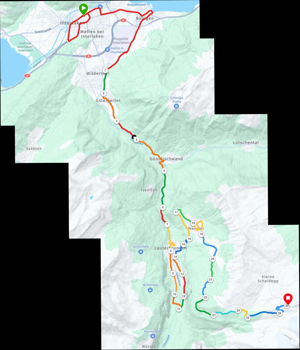
- Garmin map showing my 27 legs for pacing (JPG)
Garmin tracking
For those on the WhatsApp group, then I hope that shortly after the start (just after 0730 UK time) a link to a Garmin tracking website will be posted to the WhatsApp group – if it works, it should show an almost-live plot of where I am and the route.
Jungfrau Marathon app
There is also an app which, if it works, may show my position and other information. My race number is 4480.
- Android: https://play.google.com/store/apps/details?id=events.tracx.jungfraumarathon&hl=en
- Apple: https://apps.apple.com/us/app/jungfrau-marathon/id6459922606
The route / maps
See also my post on analysing the Jungfrau route
- Swisstopo map (PDF, single page)
- Outdooractive map (PDF, single page overview then more detailed maps)
- Simple panoramic map hinting at elevation (PDF)
- Garmin map showing my 27 legs for pacing (JPG, see above for my pacing plan)
Webcams
- Wengen (above the Männlichenbahn station) – part of the route through the main street visible, and then running back past the skating rink and under the cablecar wires
- Lauberhorn – views of Eigergletscher station in the distance with a small part of the route visible as it climbs to the finish over railway line
- Eigergletscher – camera is rather tucked away: the grey station building is where the marathon finishes but essentially none of the route is visible but a good idea of the weather etc
Leave a Reply