As I mentioned in my intro post on the Jungfrau Marathon, while the primary goals are to finish and to enjoy the occasion and the challenge, I do want to think about pacing. In many previous races, pacing planning has been a tool to help guide me to a particular finish time as a primary goal, and valuable both to stop me going too fast and to ensure I am going fast enough.
While here the finish time is not a primary goal, being aware of times and paces is still useful – indeed critical in ensuring I meet the cut-off times at Wengen and Wixi. Additionally, if I can work out what is right for me, and then train for that, I can seek to ensure I do have the strength to enjoy the day and complete it safely.
Pacing is a much simpler equation on an essentially flat race on roads or paved paths (which is largely my experience thus far), or where there are hills of relatively modest elevation and the equations around expected pace are predictable.
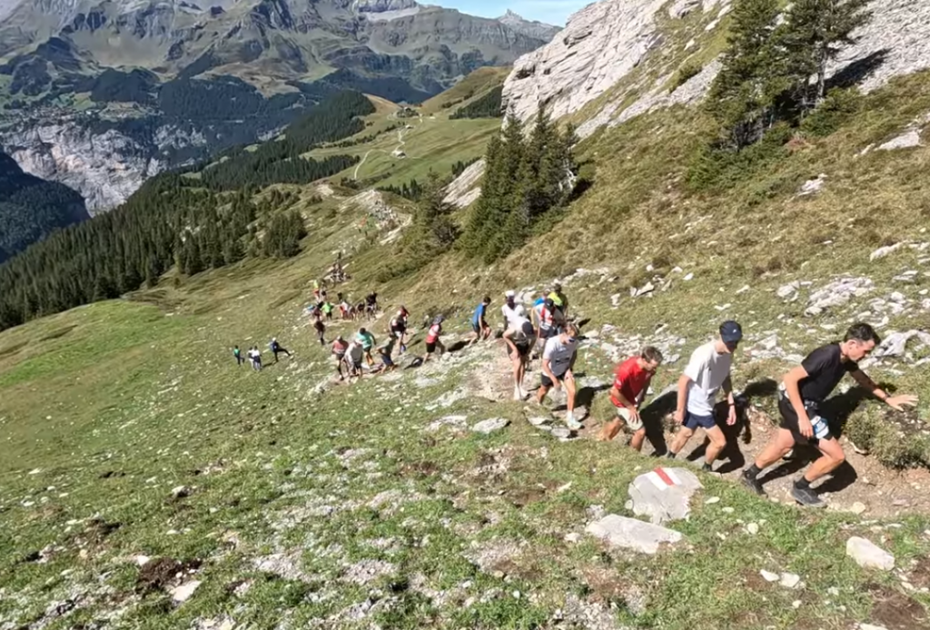
Here things look very different – a punishing and uneven elevation profile, and a variety of surfaces underfoot too.
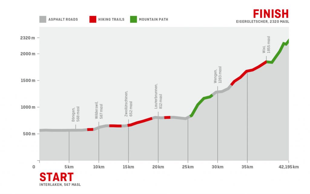
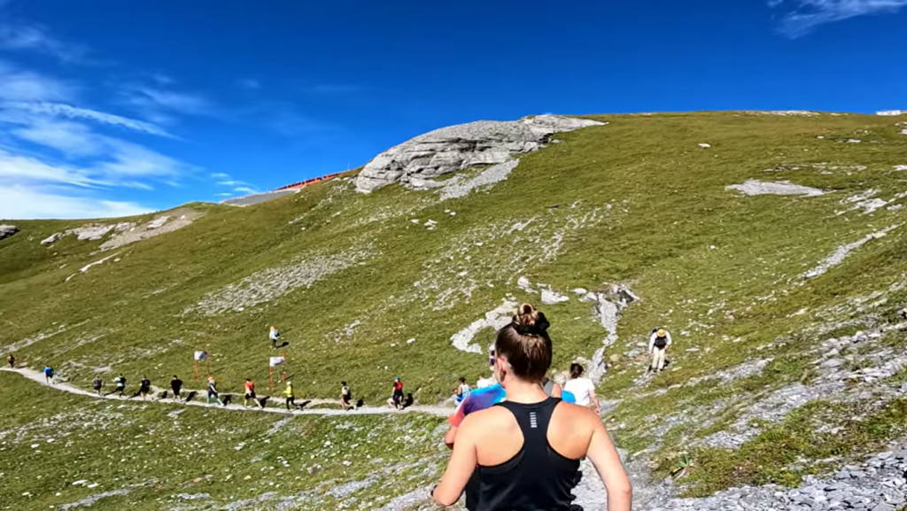
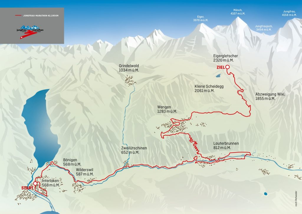
In its simplest form, it’s two unequal halves. Its perhaps slightly more accurate to consider the still simple but slightly more refined four sections: 10km essentially flat and almost all tarmac to Wilderswil, 16.3km trending a little uphill through and then back to Lauterbrunnen railway bridge on mostly easy paths and tarmac, 13.1km very steeply uphill through Wengen and continuing uphill as far as Wixi on a mixture of decent paths, tarmac roads and gravel roads, and 3.3km steeply uphill on hiking paths to Eigergletscher including some much more challenging conditions underfoot. And while the trend is firmly uphill, there are short level and downhill sections thrown in to mix things up a bit.
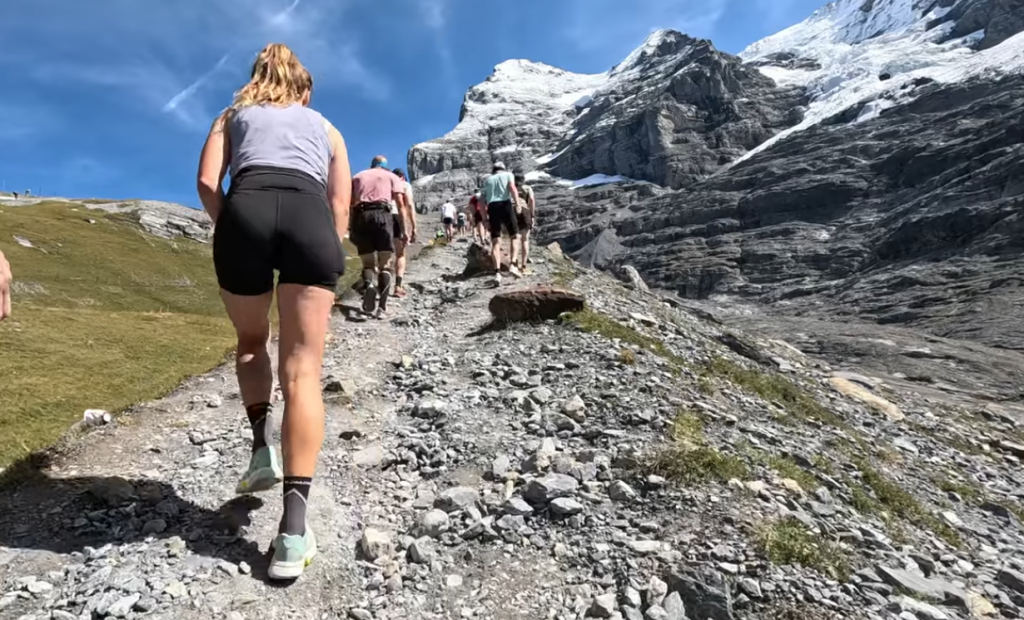
The 16.4km onwards from Lauterbrunnen railway bridge to the finish is partly a brisk steep uphill walk and partly a steep uphill mountain hike, with a few bits of jogging on very tired legs on varied terrain thrown in for variety.
Incidentally, I don’t think those colour-coded elements on the elevation profile, above, are terribly helpful – almost all of the lower red is pretty good underfoot; most of the first batch of green and the second red are fairly good (though steep); but almost all of the upper green is very hard going quite apart from the steepness.
For a 6 hours 30 minutes overall finish time, the runningcoach.me website suggests The Wall (kms 27 and 28) at 18:19 and 18:59 which I find moderately encouraging as I’ve brisk walked up Walna Scar from the Duddon Valley (in the Lake District) for 2km which is a similar gradient (gaining about 360 metres) at a slightly faster pace than that – on rested legs, of course, but also without training and without a firm objective, and probably on slightly less good conditions underfoot in places.
My first effort at a pacing approach uses a running calculator to produce a pace based solely on net ascent, then a factor to incorporate growing tiredness, and a factor to incorporate varied terrain/footing, all scaled to produce a 6h30 finish time for the moment. This produces paces from 5:56/km to 20:18/km which at least feels plausible.
So at this early stage, my own first effort at a pacing approach breaks it up into 12 sections and gives the following (coincidentally with some nice round figures – it’s just the way the maths comes out):
- 2h50 to Lauterbrunnen railway bridge (i.e. the village for the second time)
- 3h50 to Wengen railway station [cut-off is 4h25]
- 5h20 to Wixi [cut-off is 5h50]
- 6h30 to Eigergletscher
runningcoach.me (when pressed for a 6h30 finish rather than its initial 5h45 estimate) gives
- 3h01 to Lauterbrunnen
- 4h05 to Wengen railway station
- 5h28 to Wixi
- 6h30 to Eigergletscher
My own first draft amateur pacing has me a fair bit faster than runningcoach’s pacing in the first 26km, slightly faster up the Wall, then slower from Wengen to the top. Varied terrain/footing is likely to make a significant difference to pace, and while one can question my own assumptions in that regard, it certainly isn’t known to the runningcoach website’s calculator.
I’d also like to plan for a slightly bigger margin in hand at Wengen than at Wixi. Something to keep under review. None of the automated pacing calculators takes any account of terrain: much of it towards the top is rough hiking trails with rocks and trees to step over, but – equally – not all of it, and the majority beyond Wengen is on gravel roads.
And as a mildly interesting comparator, I present Gregor Bischof, who in 2024 was one year older than I am now, and who finished a few seconds inside 6h30:
- 2h46 to Lauterbrunnen
- 3h44 to Wengen Railway Station
- 5h18 to Wixi [cut-off is 5h50]
- 6h30 to Eigergletscher [nominal cut-off is 7h00 but people finished at 7h20 last year]
He’s unknown to me, and I just picked him out of the results list on the sole basis of picking a man of my own age finishing in around that time, with no idea how representative he is: he’s ended up with a set of times pretty similar to my own estimates – a slightly faster time as far as Lauterbrunnen, a smidgen quicker to Wengen, a bit faster to Wixi, and then a tad slower to the top. A real world, lived, experience – but no particular reason to expect the same, though perhaps a warning not to under-estimate how slow the last bit could be.
I would normally also give Garmin’s PacePro strategy calculation a serious look, but I don’t think it goes nearly slowly enough on the really steep sections (nor, of course, does it take terrain/footing into account), which is a shame as it could be a really valuable tool to have on my wrist to monitor how I am doing along the route.
It is possible to edit the paces Garmin suggests manually, and I may well create something that way nearer the time, when I’ve got a clearer idea of my capabilities and how slow to plan to go uphill.

Leave a Reply